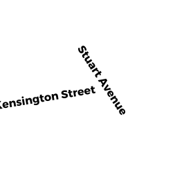
115 STUART AV UN 16
Owner Information
MORAN DIANE L.
115 STUART ST UN 16
DRACUT, MA 01826


Property Details
115 STUART AV UN 16 is classified as a Condominium (Condominium).
The primary structure on this property was built in 1985. There are 2,032ft2 of built area within this property. There is 1,232ft2 of residential/living space within this property. This property is listed as having 5 rooms.
115 STUART AV UN 16 is valued at $238,500. The land is valued at $0 and the structures are valued at $238,500.
The most recent deed for 115 STUART AV UN 16 is recorded at the local registrar in Book 30092, Page 0191. 115 STUART AV UN 16 was last sold on Wednesday, June 1, 2016 for $185,000.
Assessment data from fiscal year 2022.
Flood Data
According to the FEMA National Flood Hazard Layer, this property does not appear to be in a flood zone. It may also be in an area not yet reviewed. Nonetheless, confirm this information prior to taking any action.
To view the flood hazards around this property, create a FEMA "Firmette" Map of the area around 115 STUART AV UN 16.
Broadband Internet Providers
| Provider | Type | Bandwidth (mbps) | |
|---|---|---|---|
| GCI Communication Corp. | Satellite | 0 | 0 |
| T-Mobile | Fixed Wireless | 25 | 3 |
| Comcast | Cable | 1000 | 35 |
| Verizon New England Inc. | DSL | 7 | 0 |
| Viasat Inc | Satellite | 100 | 3 |
| VSAT Systems, LLC. | Satellite | 2 | 1 |
| HughesNet | Satellite | 25 | 3 |
Broadband service provider data from December 2020.
Adjacent Properties
- 115 STUART AV UN 01
Condominium owned by LEBLANC CHERYL A., TRUSTEE - 115 STUART AV UN 10
Condominium owned by MALANEY PATSY-JO - 115 STUART AV UN 11
Condominium owned by STACY ANN E. - 115 STUART AV UN 02
Condominium owned by SERVIZIO ANTHONY (JTRS) - 115 STUART AV UN 03
Condominium owned by KLARAKIS ANTONIOS D. (JTRS) - 115 STUART AV UN 04
Condominium owned by WIRTH DENNIS J. (JTRS) - 115 STUART AV UN 06
Condominium owned by HOWARD BRIAN A. - 115 STUART AV UN 07
Condominium owned by MACCUTCHEON TAYLOR - 115 STUART AV UN 08
Condominium owned by MEREVES DIMITRA - 115 STUART AV UN 09
Condominium owned by HAYES LORI L. - 115 STUART AV UN 05
Condominium owned by FULTON MICHAEL, TRUSTEE - 983 METHUEN ST
Single Family Residential owned by CONNOLLY MATTHEW (TE)